





 Feed
Feed Scan with QR Code Reader
 mobi
mobi- Advertise / Donate
Welcome !
Newquay weather receives over 1000 vistors per day winter time, rising to over 3000 to 4000 or more in the summer, including visitors from all over the world.
Please help support this site

Your business

Via Paypal
- Accommodation
Hotels, B&B's and Caravan and Camping Sites

Porth Sands - Luxury beach accommodation wth beach facing balconies, a golden sandy beach making it the perfect place to idle away the hours- swimming, body boarding, sunbathing and paddling.
- Food
Restaurants, Cafe's, Takeaways

Pachanga - Pachanga Authentic Mexican Since 2016 we've been re-creating dishes that are part of our cultural heritage using techniques that are unique to Mexico. We use mostly Mexican, local & organic produce in our dishes & drinks
- Charity Events
Charity Events - Max 3 free ads
For a Free Charity Ad Here, please contact me- - Houses for Sale
Houses for Sale
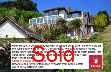
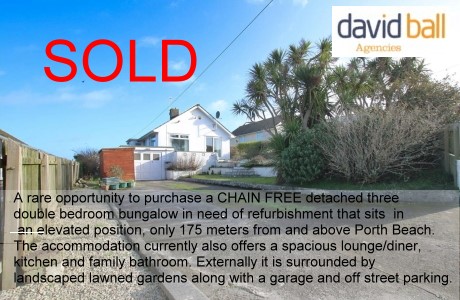
Advertise your house for sale here and help support this site.
Small photo, text + link to agents for a One off ₤25. Please contact me.Advertise your house for sale here
- Local Services
Shops, Services etc

Towan Insurance BrokersCornwall's local commercial insurance specialist. We help Cornish businesses find the right cover, from tradespeople and property owners to specialist contractors. Based in Cornwall, independent, and genuinely invested in the businesses we work with. Visit us at Towan Insurance Brokers
National Hurricane Center Graphical Tropical Weather Outlooks
From NOAA| National Hurricane Center Graphical Tropical Weather Outlooks |
|---|
National Hurricane Center Graphical Tropical Weather Outlooks |
September 4th, 2026 19:21:15 EDT -0400 Atlantic Tropical Weather Outlook

000 ABNT20 KNHC 042321 TWOAT Tropical Weather Outlook NWS National Hurricane Center Miami FL 800 PM EDT Fri Sep 4 2026 For the North Atlantic...Caribbean Sea and the Gulf of America: Tropical cyclone formation is not expected during the next 7 days. $$ Forecaster Hagen |
September 4th, 2026 19:24:41 EDT -0400 Eastern Pacific Tropical Weather Outlook

225 ABPZ20 KNHC 042324 TWOEP Tropical Weather Outlook NWS National Hurricane Center Miami FL 500 PM PDT Fri Sep 4 2026 For the eastern and central North Pacific east of 180 longitude: Active Systems: The National Hurricane Center is issuing advisories on Hurricane Karina, located several hundred miles east of the Hawaiian Islands, on Hurricane Lowell, located several hundred miles south-southwest of the Hawaiian Islands, and on Hurricane Marie, located several hundred miles west-southwest of the southern tip of the Baja California Peninsula. Offshore of Southwestern Mexico: An area of low pressure may develop well offshore of southwestern Mexico early next week. Gradual development is possible, and a tropical depression could form around the middle of next week while it moves west-northwestward at 10 to 15 mph, remaining well offshore of Mexico. * Formation chance through 48 hours...low...near 0 percent. * Formation chance through 7 days...medium...50 percent. $$ Forecaster Hagen |
September 4th, 2026 19:24:41 EDT -0400 Central Pacific Tropical Weather Outlook

228 ACPN50 PHFO 042324 TWOCP Tropical Weather Outlook NWS Central Pacific Hurricane Center Honolulu HI Issued by NWS National Hurricane Center Miami FL 200 PM HST Fri Sep 04 2026 For the central North Pacific...between 140W and 180W: Active Systems: The National Hurricane Center is issuing advisories on Hurricane Karina, located several hundred miles east of the Hawaiian Islands, on Hurricane Lowell, located several hundred miles south-southwest of the Hawaiian Islands, and on Hurricane Marie, located several hundred miles west-southwest of the southern tip of the Baja California Peninsula. Tropical cyclone formation is not expected during the next 7 days. $$ Forecaster Hagen NNNN |
Updated 19th Oct 2020